Geomorphological mapping
Geomorphological mapping using satellite imagery forms the foundation of most of Sedbase’s modern spatial datasets. Mapping hundreds of systems across the globe has been a multi-year effort by the Sedbase team.
Main geomorphological mapping objectives
-
To better understand the evolution of systems during the Holocene.
-
To relate system architecture to shoreline depositional processes.
-
To accurately interpret the shapes and sizes of geobodies, such as channel belts, from satellite data.
-
To create datasets that serve as depositional analogues for subsurface interpretation.
Overview of Mapping Methodology
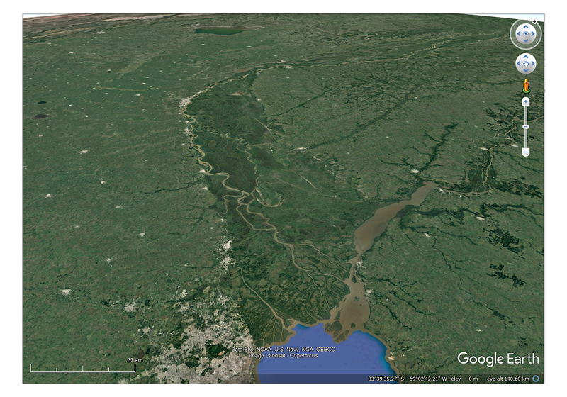
Geomorphological mapping typically begins with the selection of a system (e.g., Rio de la Plata, Argentina), which is then systematically mapped. We currently have over 300 systems mapped, achieving broad global coverage.
The end product is an interactive map containing multiple geomorphological layers, including:
-
Beach ridges
-
Active and abandoned channels
-
Scroll bars
-
Standing bodies of water
-
Bathymetric contours
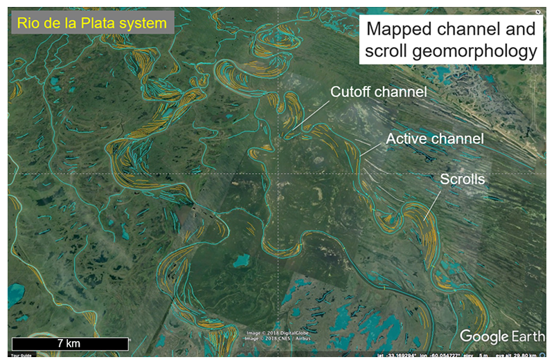
Every effort has been made to ensure high-resolution detail to support the interpretation of depositional history and to delineate geobodies of interest, such as channel belts.
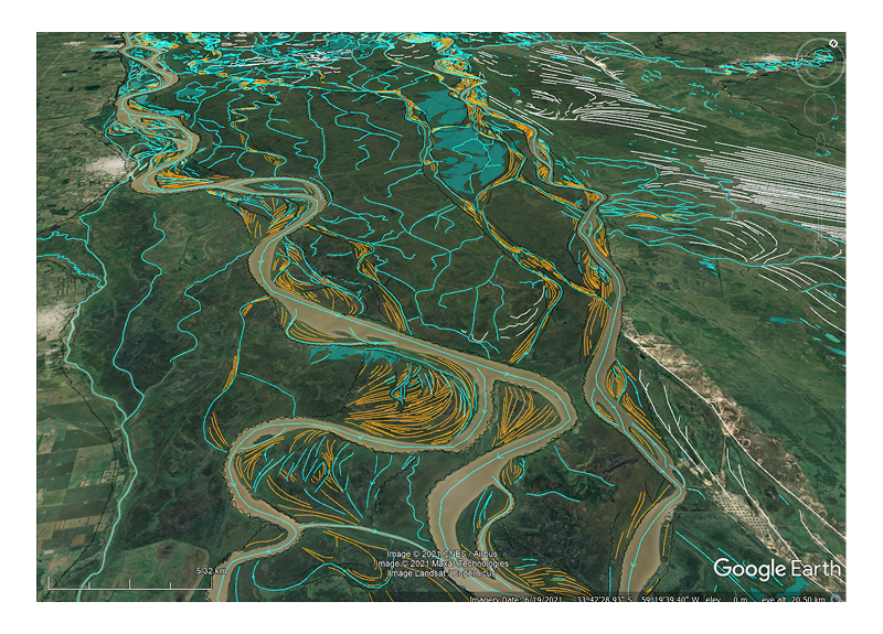
Example of a Mapped Area
The example below shows a completed map, ready for geobody mapping and depositional architecture interpretation.
In this image:
- Orange lines represent mappable scroll bars
- White lines denote beach ridge deposits
- Blue lines indicate active or abandoned channels
- Light blue polygons show standing bodies of water
All mapping was performed using present-day satellite imagery as well as historical imagery for added context.